Sinbad Creek Stewardship
Alameda Creek Alliance Sinbad Creek Stewardship
Goals: To collect baseline information about Sinbad Creek, and to inform and involve community members in creek stewardship. This includes mapping Sinbad creek, and gathering basic water quality data about the creek.
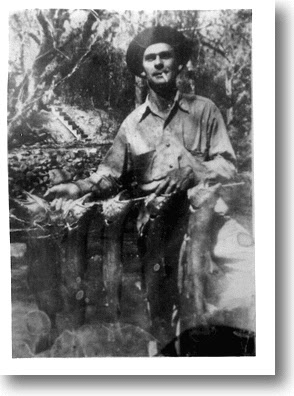
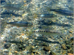
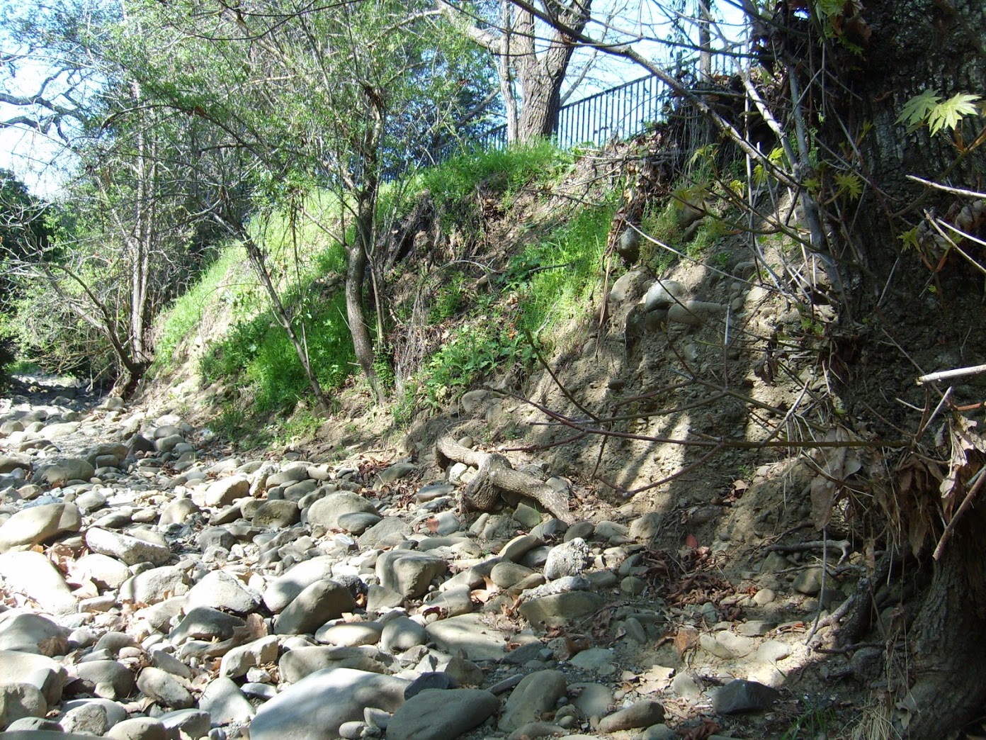
Description of the Project: Steelhead trout historically inhabited Alameda Creek and its tributaries, including Sinbad Creek. Sinbad Creek is known to have habitat suitable for steelhead spawning, based on gravel, flow, and migration barriers. Sinbad Creek is likely to only intermittently support steelhead migration during the November to April in-migration period. Low flows during the dry season causes the creek to dry up, limiting the suitability of Sinbad Creek as year-round rearing habitat for juveniles.
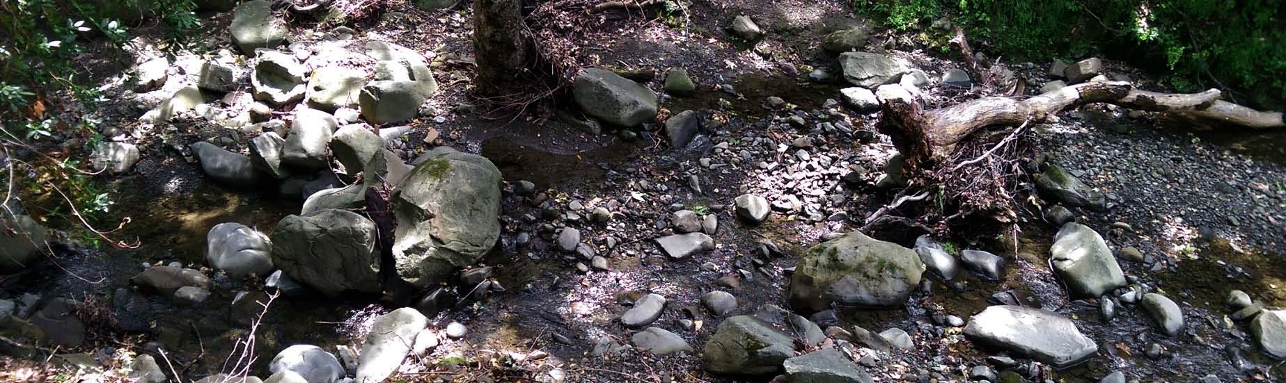
Sinbad Creek is a first order tributary to Arroyo de la Laguna, which, approximately one-half mile downstream of its confluence with Sinbad Creek, enters Alameda Creek, the largest tributary in south San Francisco Bay (Figure 2). Sinbad Creek is 7.5 miles long, and drains 6.44 square miles. It flows south from its headwaters through Pleasanton Ridge Park, along a wooded residential road (Kilkare Road), and through the small town of Sunol. Historical evidence shows that steelhead (Oncorhynchus mykiss) once inhabited Alameda Creek and its tributaries, including Arroyo de la Laguna and Sinbad Creek.
An Assessment for the Potential for Restoring a Viable Steelhead Trout Population in the Alameda Creek Watershed (Gunther et al. 2000) identified that:
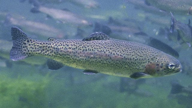
• Adult steelhead (approximately 20-28 inches) will migrate upstream
to spawn in Alameda Creek and its tributaries between November and April,
with the majority of in-migration occurring between December and March.
• Juvenile steelhead will inhabit Alameda Creek and its tributaries from one to four years before migrating to the ocean as smolts, usually between April and June or during the first rains of the fall.
• Steelhead will spawn at depths of 0.3 to 5.0 feet, current velocities of 0.75 to 5 feet per second, and in gravel of 6.4 to 127 millimeters in diameter
• Steelhead in the San Francisco Bay area often use intermittent streams for spawning and rearing.
In 2013 the Alameda Creek Alliance surveyed Sinbad Creek and outreached to Sunol residents about stewardship opportunities along the creek. We found high community support for activities such as water quality and biological monitoring, invasive species removal, green infrastructure projects, and general restoration planning. Furthermore, the community around Sinbad Creek expressed strong interest in better understanding the hydrology of the creek and how it is changing over time. The monitoring activities proposed in this project are meant to forward those community goals and to provide baseline data about the creek, which is necessary for targeted and effective stewardship activities.
Our Sinbad Creek Stewardship Project consists of three parts: (1) mapping of the creek, (2) water quality sampling, and (3) presenting findings to the Sunol community

1. GPS mapping of Sinbad Creek and development of a creek map
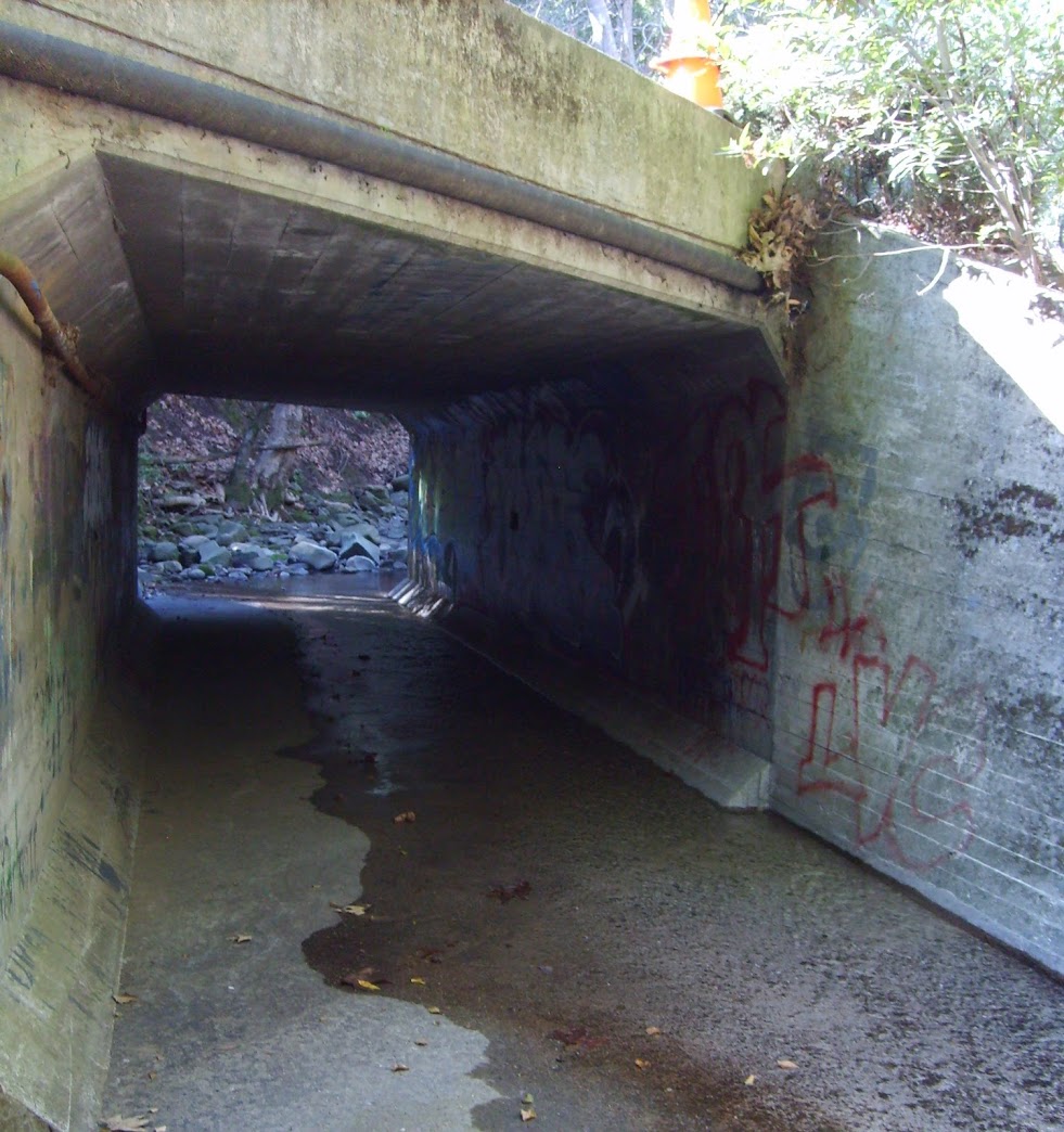
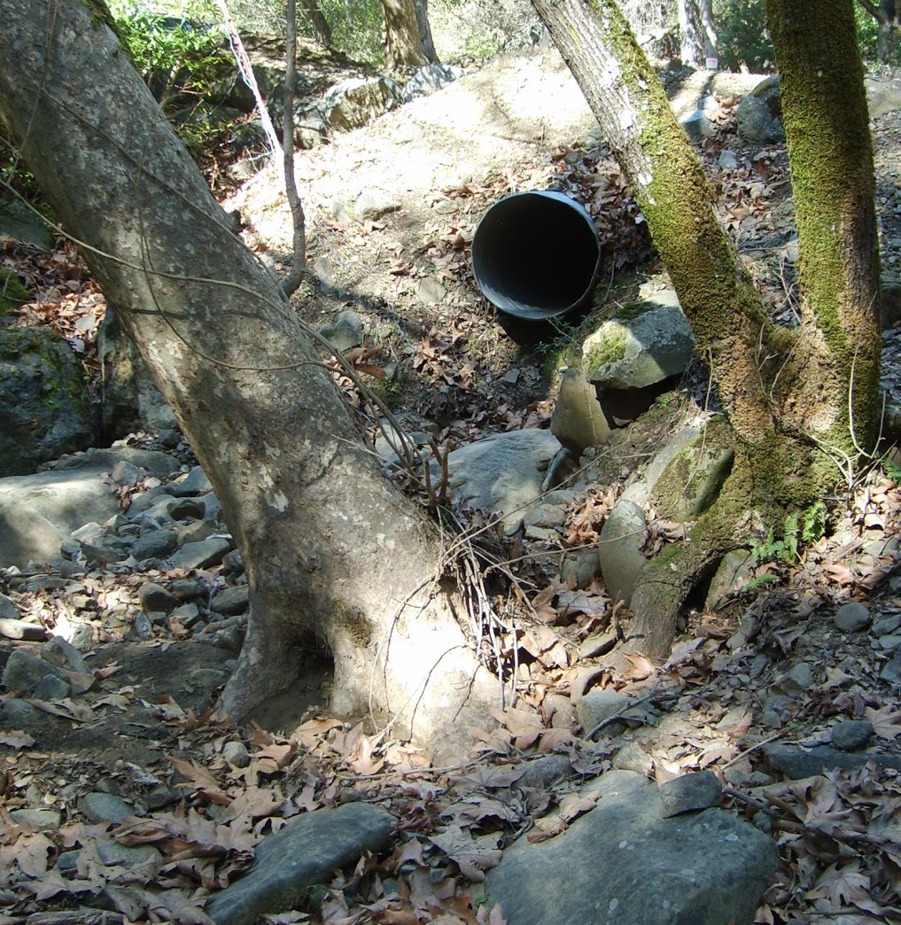
Using protocols developed for the Contra Costa Watershed Atlas, we will use GPS technology to map Sinbad Creek, from its downstream confluence at Arroyo de la Laguna to the headwaters in Pleasanton Ridge Regional Park. We will denote the nature of the stream banks, map culvert crossings by type, and map weirs or other structures in the creek.
Goals include production of maps that contain information on the nature of the banks along the length of Sinbad Creek, where outfalls (culverts) or other constructed features occur, and where our water quality sampling locations are. An additional goal is a map of where invasive plant species occur along Sinbad Creek.
Products: Paper and digital maps that can be shared with the community and updated over time. Maps and related files will contain data collected by volunteers during their GPS survey, and will help to outreach about Sinbad Creek to community members.
2. Water quality measurements
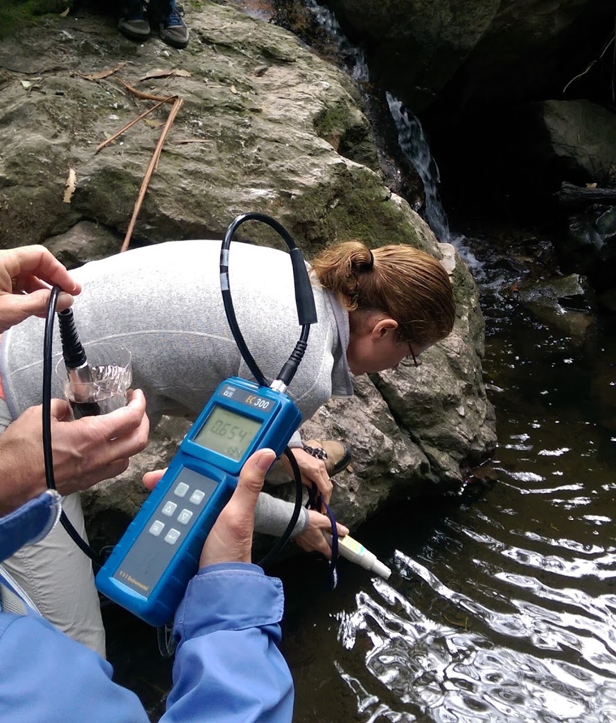
Our monitoring plan for water quality consists of three parts: (A) water temperature monitoring, (B) sampling for bacteria, and (C) sampling for benthic macroinvertebrates (insects and insect-like organisms that live in the creek). Our sampling locations occur at turnouts along Kilkare Road, where there is safe parking and access to Sinbad Creek.
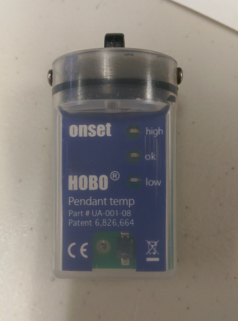
A. Water Temperature Monitoring. A better understanding of the seasonal nature of Sinbad Creek and its water temperatures are a key component to any potential restoration of steelhead populations. We will purchase and install several in-stream HOBO Water Temperature Pro data loggers. These data loggers record stream temperature continuously, recording a measurement every 15 minutes. In addition to water temperature, the data logger will indicate when the creek dries up, and if and when it runs again.
A trained volunteer will visit each data logger monthly to download and manage the data. Five locations for the data loggers have been identified for the instruments, based largely on creek access and availability of vehicle parking. We will install the data loggers during the dry season (August or September 2016), and expect to gather data for a minimum of a year, and for as long as the instruments remain viable.
B. E. coli and total coliforms. We will sample Sinbad Creek water for E. coli and total coliform at the same locations once each week for five weeks during the 2017 winter season (likely January-February). Samples involve collecting 100 ml of creek water per sample, and the 5 weeks of samples at each location are combined to give a single robust value. Sampling will follow protocols established by the EPA (SOP 1106), and will be delivered to the EPA laboratory at the Richmond Field Station where they will be processed and analyzed.
Creeks with development around them tend to be highly impacted by humans. Sewage leaks are not uncommon during the rainy season, when rain can infiltrate the pipes that carry our waste and overload the system, causing some amount of pipe overflow. Other reasons behind sewage contamination in the creeks include storm-water runoff, leaky septic systems, farm animals, and even waste from pets.
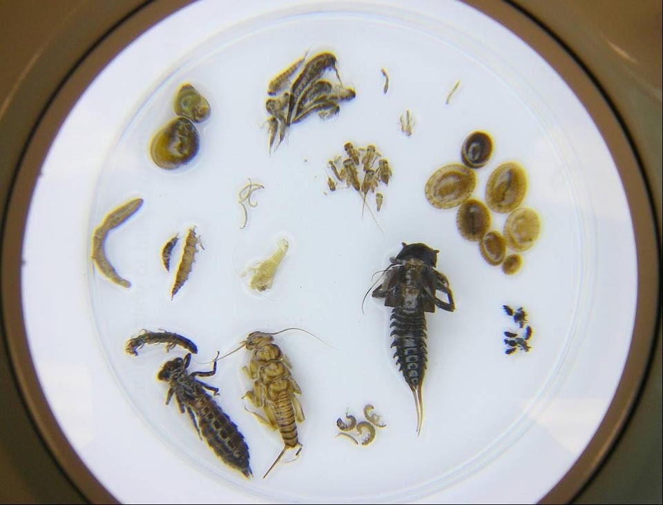
C. Benthic Macroinvertebrate Sampling. We will sample for benthic macroinvertebrates (BMIs) to evaluate long-term trends in watershed health, rather than the momentary and highly variable snapshot that nutrient or dissolved oxygen sampling provide.
Surveys for benthic macroinvertebrates will take place at two locations- one in lower Sinbad Creek (adjacent to the Sunol Community Park), and one in the upper watershed, near Pleasanton Ridge Regional Park.
These aquatic organisms can be divided into groups that are tolerant of pollution or degraded water quality, and those that are intolerant. By sampling these organisms and examining the ratio of tolerant to intolerant we get an idea of long-term water quality. The benefit of BMI sampling is that by finding a healthy population of low-tolerance invertebrates (i.e. mayflies, stoneflies, and caddisflies) we can glimpse the recent past and know that creek conditions must have been good for some time.
The BMI monitoring program is based on one originally proposed by the Pacific Streamkeepers Federation of North Vancouver, British Columbia. The Streamkeepers protocol is less time consuming and more affordable that the SWAMP/County protocol (fewer samples are taken, and invertebrates are only identified to Family), and lends itself perfectly to being implemented as a citizen science program.
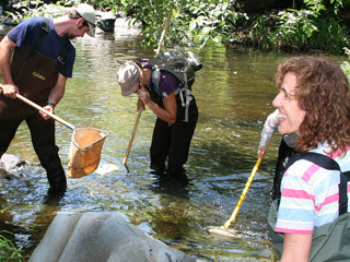
Products: Volunteer event dedicated to sampling, identifying, and counting BMIs in Sinbad Creek; Outreach materials related BMS sampling.
3. Reporting to the Sunol community
We will report and distribute our findings to the Sunol community at the completion of the project in a 4-page ‘State of Sinbad Creek’ document, which will include the creek map and the findings of all of our water quality measurements.
Products: A 4-page ‘State of Sinbad Creek’ document.
This project is funded in part thanks to a grant from the Alameda County Fish and Game Commission.