Historical Ecology
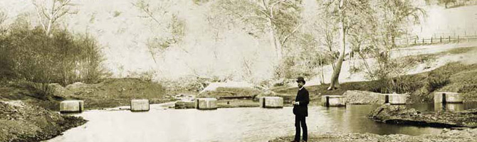
Over the past two centuries the Alameda Creek watershed has been transformed dramatically; over half the landscapes once dominated by grasslands, seasonal wetlands and streams that overflowed annually have been converted to urban development and many creeks flow through artificial channels. Many important natural features have been lost during this transformation.
What did the Alameda Creek watershed look like before European arrival and before major development? What processes controlled the distribution of habitats and native species? How have the creek and other habitats changed over time due to human influence? How can we enhance the ecological health of the watershed in the future? These questions are the focus of historical ecology, which is the study of landscapes and habitats in the historical period.
The San Francisco Estuary Institute has completed an Alameda Creek Historical Ecology Study, a comprehensive guide applying understanding of historical conditions to present-day conservation challenges. Researchers collected and synthesized thousands of historical documents such as journals, maps and aerial and landscape photographs to build a picture of the historical characteristics of the watershed. They mapped historical creek channel alignments and habitats such as lagoons, wetlands, vernal pools, oak savannas, chaparral, grasslands, alkali meadows and riparian areas. The study focuses on floodplains, valleys and alluvial plains adjacent to Alameda Creek and its tributaries in the Livermore and Amador valleys, Sunol Valley and Niles Canyon, and the Niles cone and adjoining baylands.
Some of the fascinating historical features of the watershed include: Tulare Lake, the marsh complex and freshwater wetlands with a large former extent of willow groves under present-day Pleasanton; the iodine bush and alkali wetlands of the Springtown sink; discontinuous streams in the Livermore-Amador Valley; extensive sycamore alluvial woodlands and oak savanna in Sunol Valley; and the numerous braided channels of lower Alameda Creek as it spread across the Niles cone.
The study compares past and present landscapes, analyzing changes in land cover, water transport and storage, channel connectivity, aquatic resources including fish, sediment transport, channel form and habitat types. The findings advance public understanding of the watershed and have potential applications for floodplain and water supply management. Identification of missing former habitats can help inform wetland and stream restoration opportunities and support planning efforts such as the Alameda Watershed Habitat Conservation Plan, fisheries restoration, Alameda County flood control planning and the South Bay Salt Pond Restoration Project.
Read the Alameda Creek Historical Ecology Study to learn more about the ecological history of the watershed.